Research
Remote sensing of ground ice
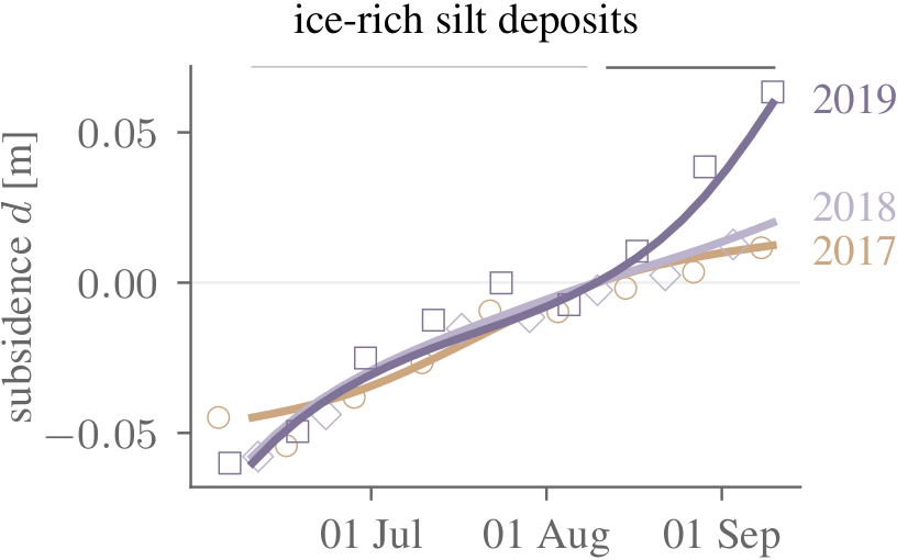 | Where permafrost is rich in ground ice, warming and disturbances can induce terrain subsidence, slumping, and collapse. However, we lack spatially resolved information on the controls on and susceptibility instability. In particular, we lack fine-scale maps of ground ice over most of the Arctic. I am currently exploring the subseasonal dynamics of thaw subsidence to constrain ice contents at the top of the permafrost. |
Acceleration of seasonal subsidence measured by Sentinel-1 in an extreme summer such as 2019 is an indicator of ice-rich permafrost.
Permafrost terrain dynamics
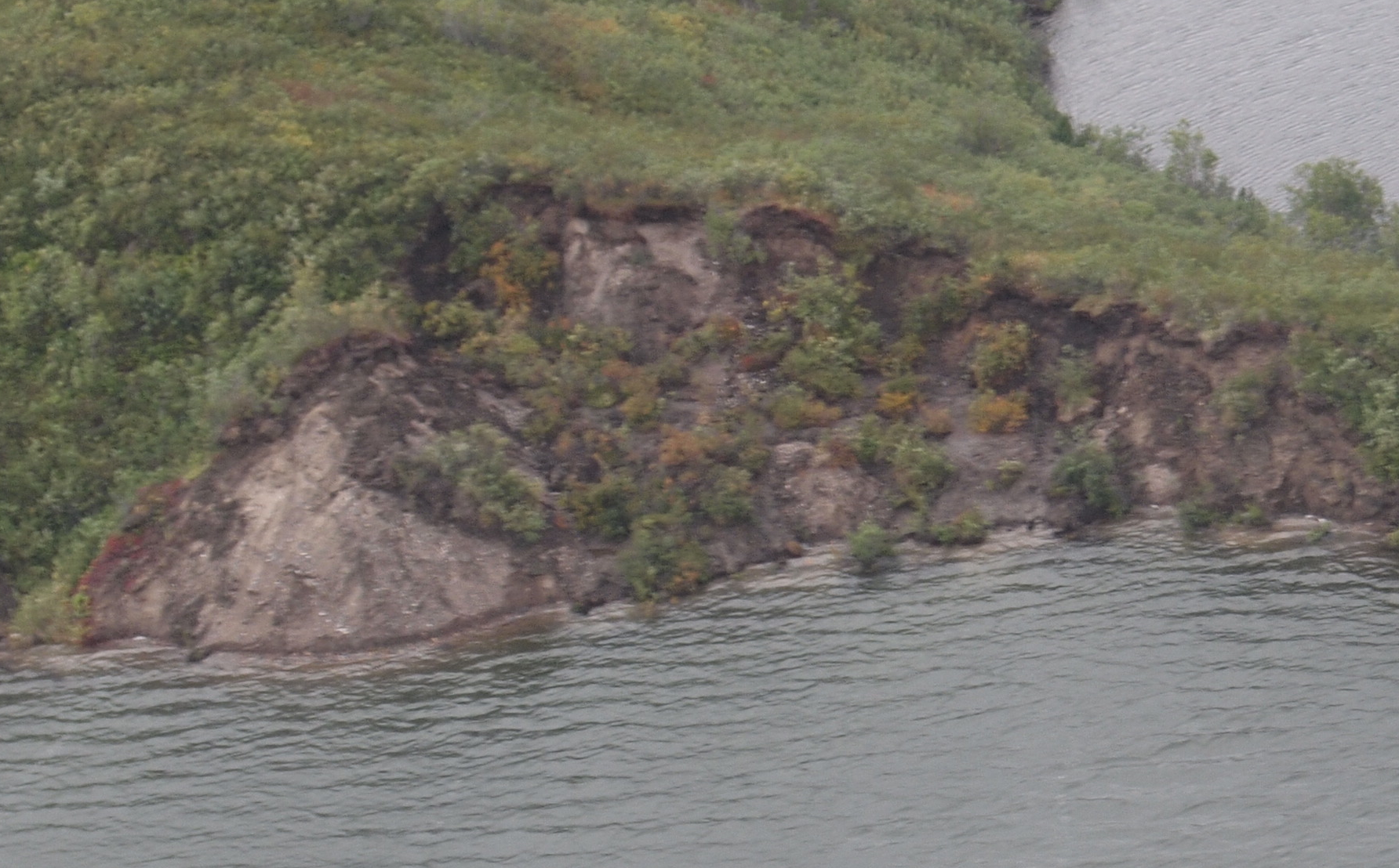 | Thaw slumps are among the most dynamic landforms that result from permafrost degradation. I am particularly interested in small slumps that feature a permanent or intermittent debris veneer on top of the ice-rich materials. Debris exerts a fundamental control on thaw slump trajectories. The coarse-grained nature of the debris predisposes the slump shown on the left to episodic retreat during exceptionally warm periods. |
Complex feedback processes control the backwasting of such debris-covered thaw slumps.
Deep learning for boreal forest health
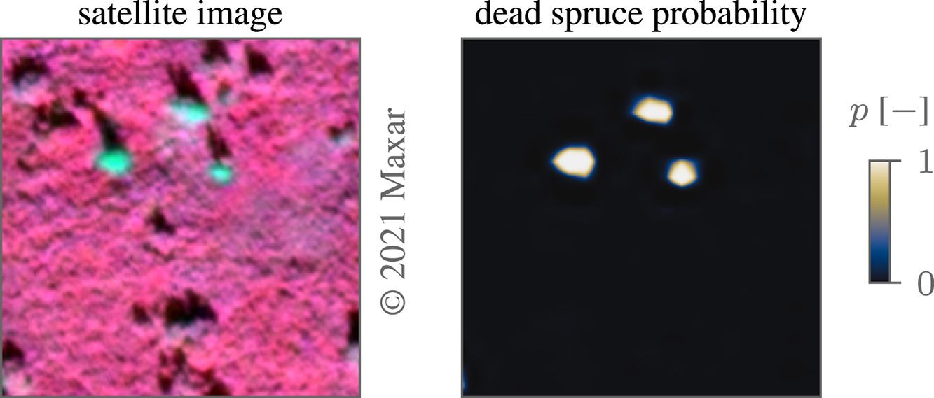 | In light of insect outbreaks, fire and permafrost degradation, stakeholders need reliable data products on forest health. For instance, tree mortality during the ongoing spruce beetle outbreak in Alaska needs to be known for fire prediction, timber and utilities management, and for understanding the ecological impacts of the outbreak. Using deep learning applied to high-resolution satellite imagery, individual dead spruce can be quantified at the tree and stand level. |
Automatic mapping of dead spruce trees using a deep convolutional neural network.