Visible and Infrared Remote Sensing 2022: Final project blog posts
Introduction
The final project is an integral part of the course. The blog posts shown below summarize the students’ final projects from 2022. Thank you to all the students who agreed to have their post published here.
Historic floods
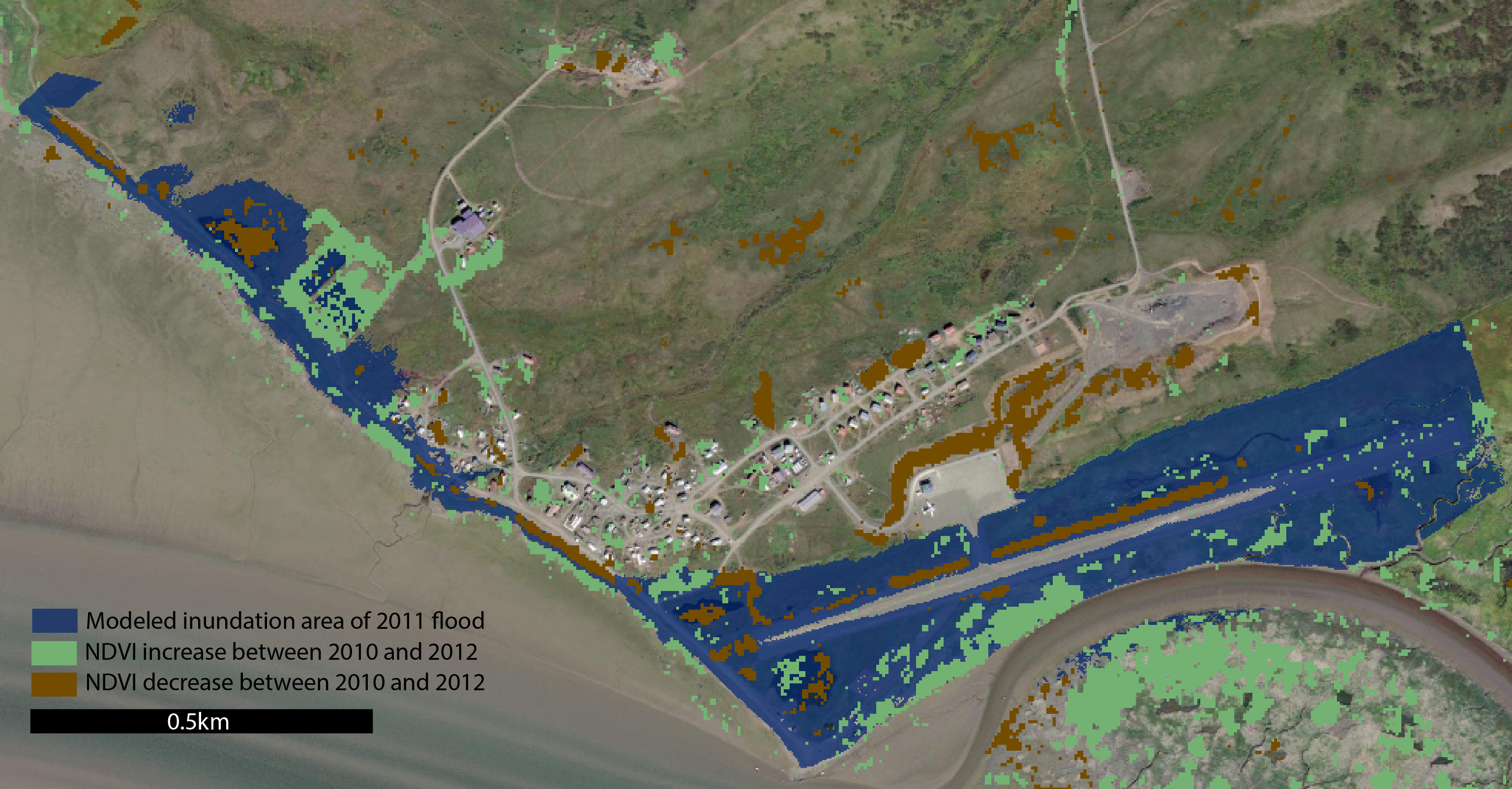 | Harper Baldwin: Exploring methods to utilize multispectral imagery to assess historic flood height in Goodnews Bay from NDVI |
Sea ice
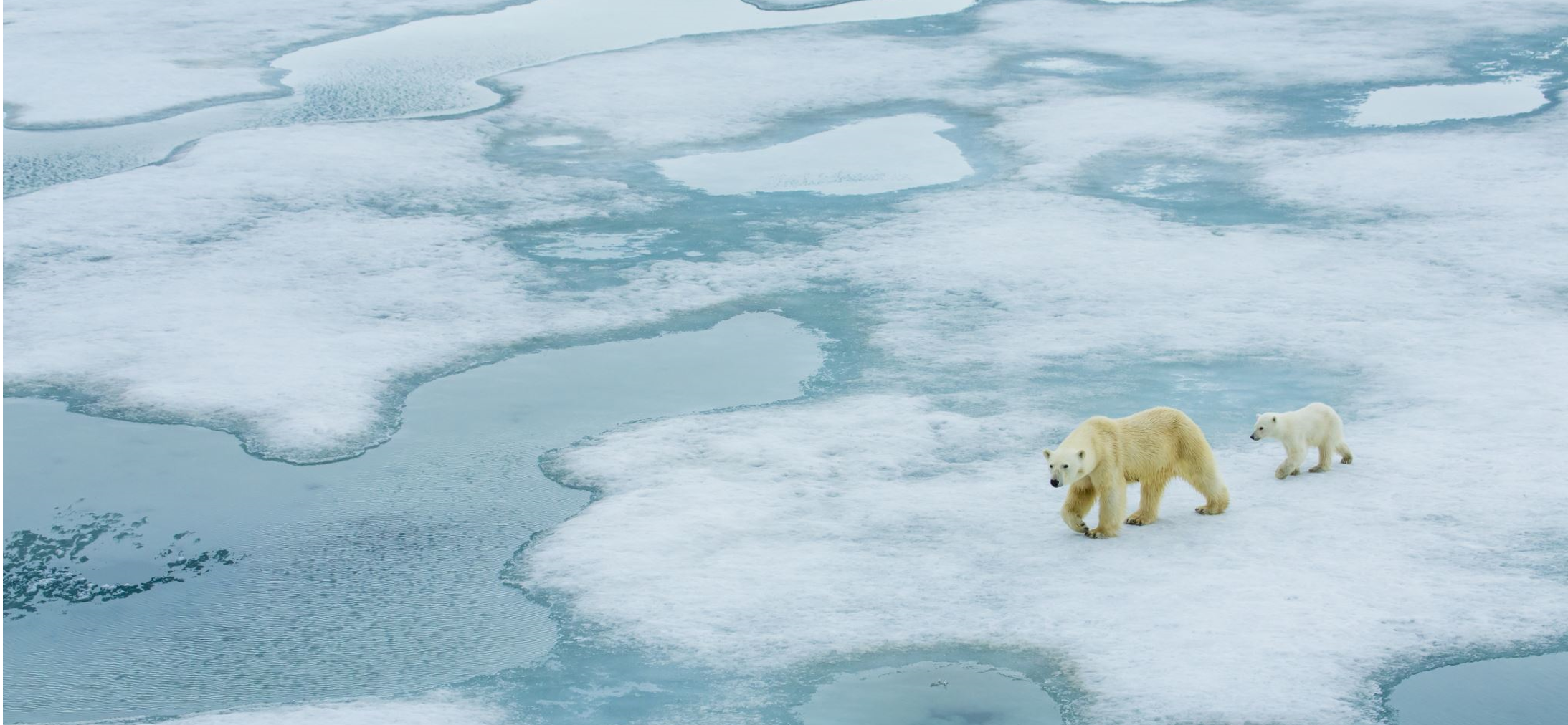 | Hannah Chapman-Dutton: How Do Summer Storms Affect Melting Sea Ice? |
Equilibrium line altitude
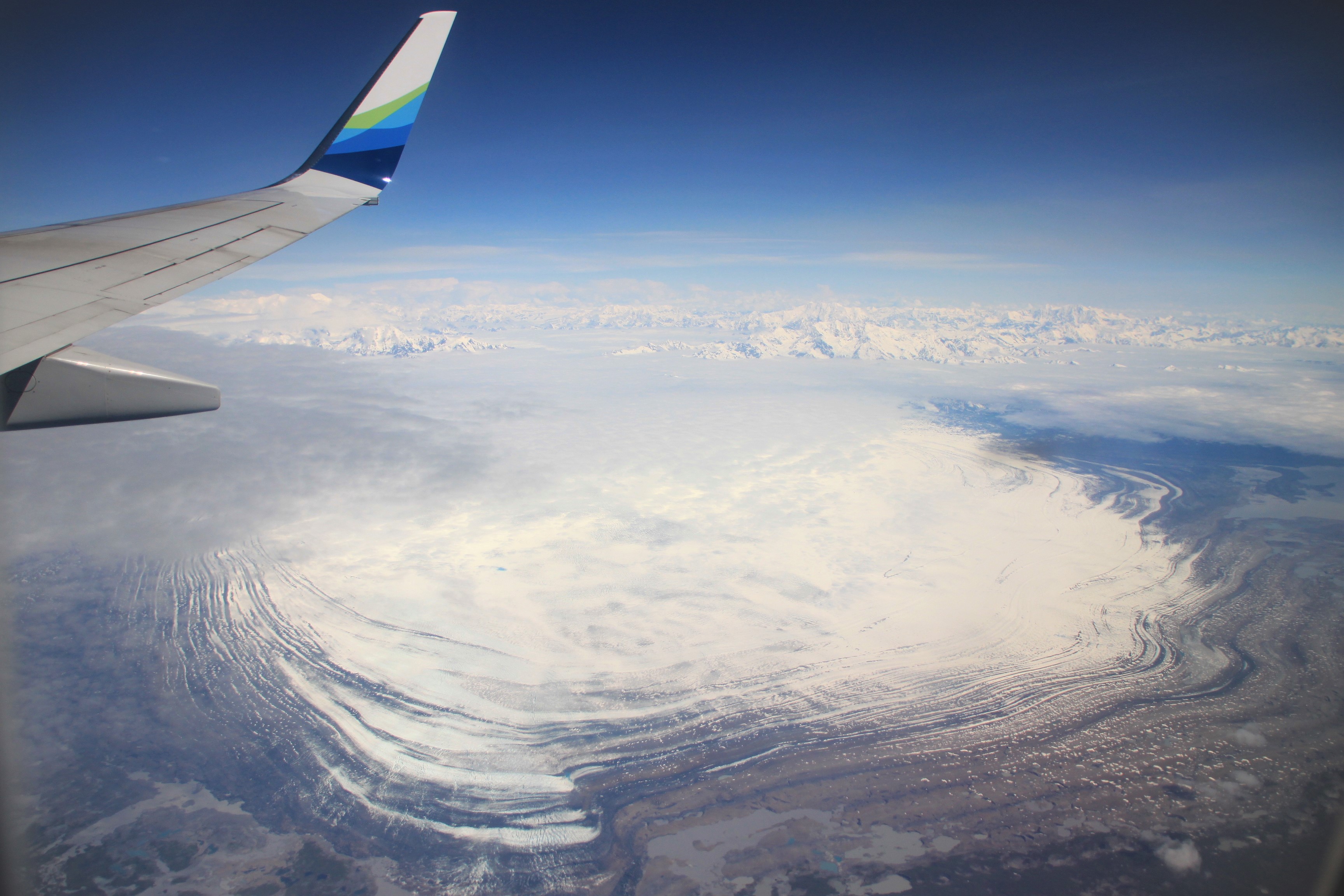 | Victor Devaux-Chupin: A workflow for Equilibrium Line Altitude automatic/by-hand retrieval from Landsat/Sentinel images |
Water body classification
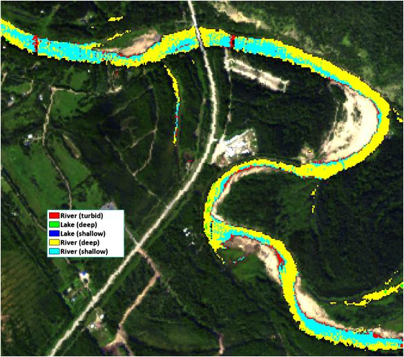 | Josh Monroe: Spectral Classification and Mapping of Alaskan Interior Water Bodies |